
Climbing El Tepozteco: The Hike, Where to Check Hours and Tips
Climbing El Tepozteco means a short but steep hike, usually one to one and a half hours up, on stone steps and rock from the top of Tepoztlán to a small pre-Hispanic temple more than 300 m above the town. The trail has been closed for long periods in recent years, and its hours and fee change, so confirm it is open with INAH or the municipality before you go.
| Question | What to expect |
|---|---|
| Time | About 1–1.5 hours up and 45 minutes to 1 hour down at an average pace |
| Difficulty | Steep and continuous: uneven stone steps, roots and rock, little flat ground |
| Altitude | The temple sits at around 2,000 m; the town at roughly 1,700 m |
| Open or closed | Changes; confirm with INAH, the municipality or your hotel before going |
| Hours and entry fee | Set by INAH and the local authorities; check the current figures, they have changed |
| Best time | Early morning, ideally on a weekday, in the dry season (November to May) |
The temple of El Tepozteco is the image of Tepoztlán: a small pyramid on a ledge of the cliffs that close the valley to the north. This guide covers what the climb is like section by section, what to carry, the best time to go and what to do if you arrive and find the gate shut. We do not publish an opening time or a price here on purpose: both have changed several times, and a wrong figure would cost you a wasted morning.
Is the Tepozteco open? Check before you go
This is the first thing to sort out, not the last. The trail and the archaeological site have spent long stretches closed in recent years, for reasons that have included the pandemic, forest fires on the mountain and decisions taken by the community of Tepoztlán, which has a strong say over its land.
Why it closes
The path runs through the El Tepozteco National Park, protected since 1937, and the summit is an archaeological zone managed by INAH (Mexico's National Institute of Anthropology and History). Fire risk in the dry months, damage to the trail after the rains and disagreements over visitor management have all led to closures. A reopening can also come with new rules: a different schedule, a cap on visitors or a changed fee.
Where to check hours and the fee
- INAH: its website, inah.gob.mx, lists the archaeological zones and their visiting conditions. INAH sites have traditionally been free on Sundays for Mexican citizens and residents; check whether that applies here when you go.
- The municipality: the Tepoztlán town council usually announces closures and reopenings on its official social media channels.
- Your hotel or guesthouse: the most up-to-date source is often someone who walked past the trailhead that morning.
Look for an announcement from the last few days, not a page or a forum post from a year ago. And carry cash in small notes, in case there is a fee to pay.
What is at the top
The reward for the climb is twofold: a temple that is more than 600 years old and a view over the whole valley of Tepoztlán.
The temple of Tepoztécatl
The pyramid was built roughly between 1150 and 1350 and was dedicated to Ometochtli-Tepoztécatl, a god of pulque, fertility and the harvest. It is small, about 10 m tall, but its position on the edge of the cliff makes it one of the most striking sites in central Mexico. According to local tradition, Tepoztécatl was also the ancient ruler of the town, and every year on 8 September the Reto al Tepozteco, a play performed in Náhuatl, retells how he was challenged and baptised. You can read more about the site on Wikipedia's El Tepozteco page.
The view and the coatis
From the platform you see the town, the 16th-century convent and the cliffs of the sierra on both sides. You will almost certainly also meet the coatis (tejones) that live on the summit. They are used to people and will go through an open bag; do not feed them, and keep food out of reach.

How the climb goes, section by section
The distance is short. What makes it hard is that the trail climbs almost without a break, so the effort is in your legs and lungs from the first ten minutes.
The start: the top of Avenida del Tepozteco
The trail starts where Avenida del Tepozteco, the street that runs up from the convent, meets the foot of the mountain. On weekends this is where queues form, so arriving early makes a real difference.
The middle: steps under the trees
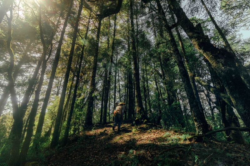
Most of the route is a staircase of irregular stone steps and boulders under oak and other trees, in a ravine between the cliffs. Shade helps, but the steps vary in height and are worn smooth in places. After rain they are slippery. Take short steps and let faster walkers pass.
The final stretch
Near the top the trail opens out and gets steeper, with a section of metal stairs before you reach the platform of the temple. At around 2,000 m altitude, people coming from sea level notice the air: stop as often as you need. The way down takes less time but is harder on the knees, and it is where most slips happen.

What to bring and when to go
- Water: at least one litre per person, more in April and May.
- Shoes with grip: trainers with good soles or light hiking boots; not sandals.
- Cash in small notes: for a possible entry fee and for food in town afterwards.
- A light layer and a rain jacket: mornings are cool, and from June to October storms build in the afternoon.
- A small backpack, closed: both hands free for the steps, and nothing for the coatis to grab.
- Sun protection: the summit is exposed.
Best time of day and of the year
Go early in the morning: it is cooler, the trail is quieter and you finish before the midday heat or the afternoon rain. Weekdays are much calmer than Saturdays and Sundays, when day-trippers from Mexico City and Cuernavaca fill the path. The dry season, from November to May, is the most comfortable for the climb. In the rainy season, from June to October, the mountain is at its greenest, but the steps are wet and storms usually arrive in the afternoon, so start even earlier. Fire risk is highest at the end of the dry season, which is also when closures have been more likely.

If the trail is closed
A closed Tepozteco does not ruin the trip. The sierra has other walks, and many of them are best done with a local guide, because they cross communal land and some are only safe in the dry season. The village of Amatlán de Quetzalcóatl, a short drive away, sits under the same cliffs and is a quieter base for a guided walk. In town, the ex-convent, the weekend market and a temazcal fill a day easily: see our guide to things to do in Tepoztlán.

To climb at first light without driving from Mexico City the same morning, stay the night before: compare options on our Tepoztlán stays page. After the descent, find somewhere to eat in the Tepoztlán restaurant directory, and see guided hikes and day trips on the Tepoztlán tours page.
Frequently Asked Questions
How long does it take to climb El Tepozteco?
Most people take one to one and a half hours to go up and 45 minutes to an hour to come down. Allow three hours in total with time at the top.
Is the Tepozteco open now?
It has been closed for long periods in recent years and its status changes. Confirm with INAH, the Tepoztlán municipality or your hotel shortly before your visit.
How much does it cost to climb El Tepozteco?
The entry fee to the archaeological zone is set by INAH and has changed over time, so check the current figure before you go and bring cash in small notes.
Is the Tepozteco climb hard?
It is short but steep, almost all on uneven steps. Anyone with reasonable fitness can do it at their own pace; take care on the way down, especially after rain.
auto_awesome Continue exploring Tepoztlán
You Might Also Like
 article Travel Tips calendar_today Oct 11, 2026
 Where to Stay in Tepoztlán: Areas, Cabins and Boutique Hotels
Where to stay in Tepoztlán depends on the trip: the centre and its barrios for walking everywhere, the valley toward Ama
 article Travel Tips calendar_today Oct 8, 2026
 Tepoztlán Day Trip from Mexico City: How to Get There & What to Do
A Tepoztlán day trip from Mexico City works best by direct bus from Terminal Sur or by car on the Cuernavaca highway, le
 article Exploring calendar_today Oct 3, 2026
 Things to Do in Tepoztlán: A Weekend Guide
A two-day plan for Tepoztlán, Morelos: the Dominican convent, the weekend market, the Tepozteco trail (check it is open